Most non-natives associate Boston's Fens with Fenway Park, where the Red Sox play. Fenway Park gets its name from the nearby Fenway road --- the road that runs along the Fens.
If you want to orient yourself to the Fens, it's here (https://www.google.com/maps/@42.3431289,-71.0946747,16z) on Google Maps; a snip appears below:
The word “fen,” of course, is an old-English term for a wetland, marsh, or swamp. Boston's Fens were once a tidal marsh, fed by the Muddy River, flowing down from Jamaica Pond (from the left, in the map above) into the Charles (top of the map, above).
When the Charles was dammed, the tidal flow stopped, and the Fens became a stinking mess, filled with the near-stagnant effluent of the area's outhouses. It was incredibly unsanitary. The poor drainage also made it prone to flooding in heavy rains.
Boston hired Frederick Law Olmstead, fresh off his triumph of designing Central Park in New York, to effect repairs. He and the architects and engineers he hired, reworked the Fens to make them an attractive, sanitary and altogether pleasant park, with good drainage; the centerpiece of a connected series of parklands and greenways comprising 1,100 acres (4.5 km2) that start in downtown Boston and sweep around the city in a long chain, now called the Emerald Necklace.
(It's a much better name than what Olmstead wanted: he called it the Emerald Girdle. Really!)
Olmstead's work did pretty well for about a century. But the City filled in parts of the flood-control areas, paved over sections of the river, and allowed invasive plants to take hold; slowing the water and interfering with drainage. By the 1990's, flooding was again a problem.
Now, the Fens are being reworked and rehabbed. The Army Corps of Engineers is currently "daylighting" parts of the Muddy River that were relegated to culverts, restoring its natural course. Funds permitting, the entire length of the Fens and Muddy River will be improved, and restored. http://www.muddyrivermmoc.org/
Last weekend, the Emerald Necklace Conservancy (http://www.emeraldnecklace.org/) organized a walking tour to see the changes.
They hired a local actor Jerry Wright to impersonate Olmstead and provide color commentary to enhance the more formal presentations given by Conservancy docents and National Park Service Rangers.
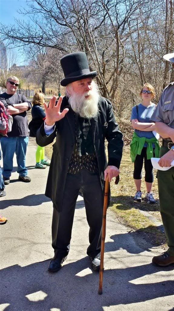
The walk was pleasant --- it was a superb, early-Spring day --- but for me the best parts were the handouts, which provided a glimpse into the Fens' past --- a past I'd never envisioned.
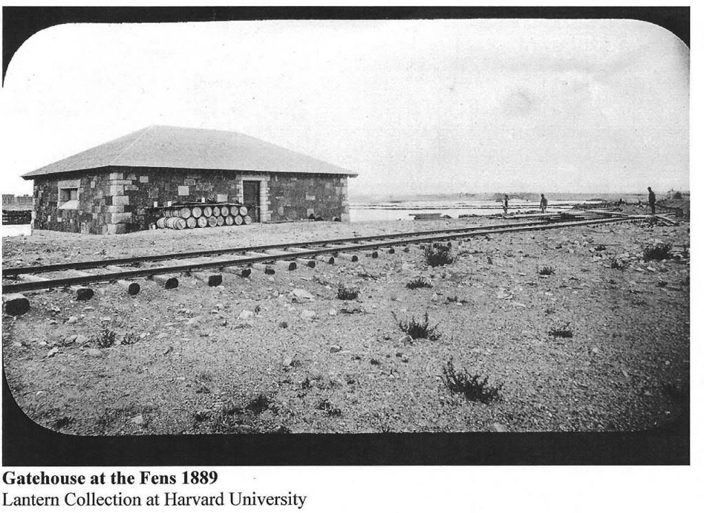
For example, here's a current Google Street View of the headquarters of the Emerald Necklace Conservancy; a converted gatehouse that used to control the flow of water from the Stony Brook into the Fens. (Google Street View: 125 Fenway)
But here's what it looked like when Olmstead's work on the Fens was just beginning:
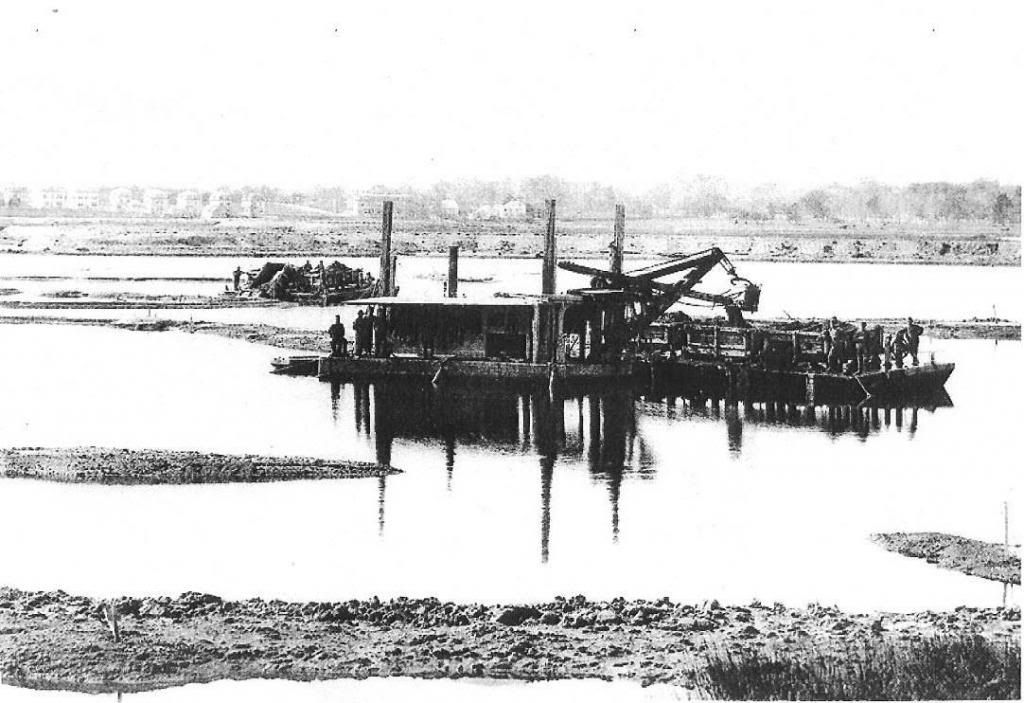
Here's the Fens being dredged:
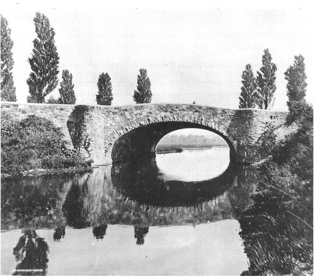
This (below) is across the street from what's now the Museum of Fine Arts, looking towards the Boylston Street bridge.
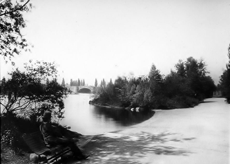
Olmstead said the bridge was the centerpiece of the Fens.
Today, it's much harder to see.
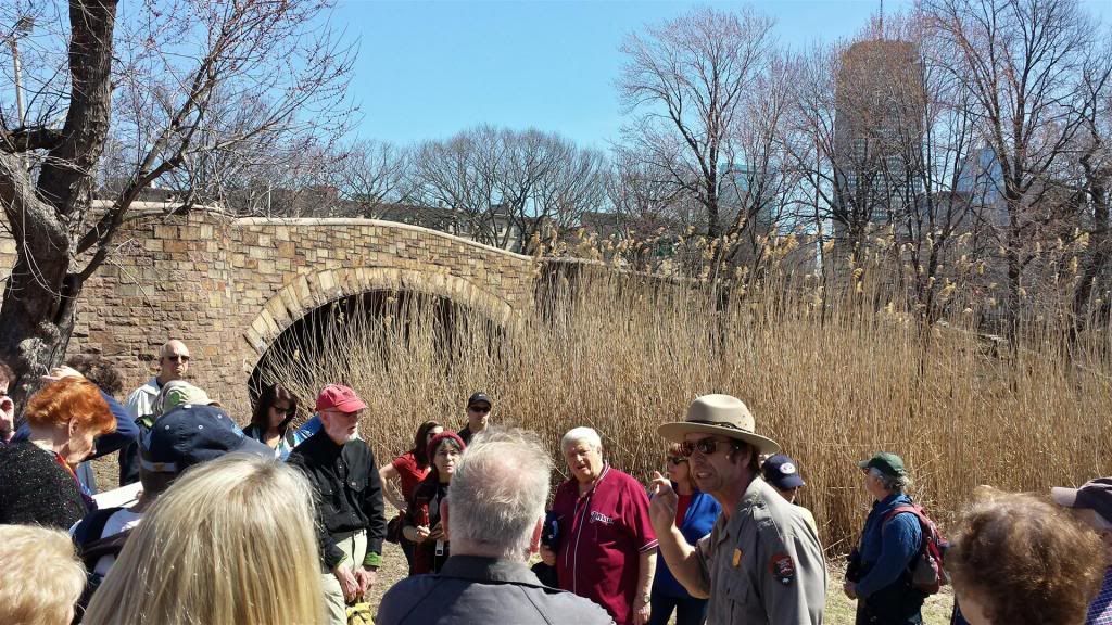
From above, at street level, it's even harder: half the bridge is now swallowed by the Bowker Overpass. (If you've ever taken the Fenway exit off of Storrow Drive, you've driven over Olmstead's bridge, and probably never knew it!)
Some other views of the Fens and the upstream Riverway in various stages of construction:
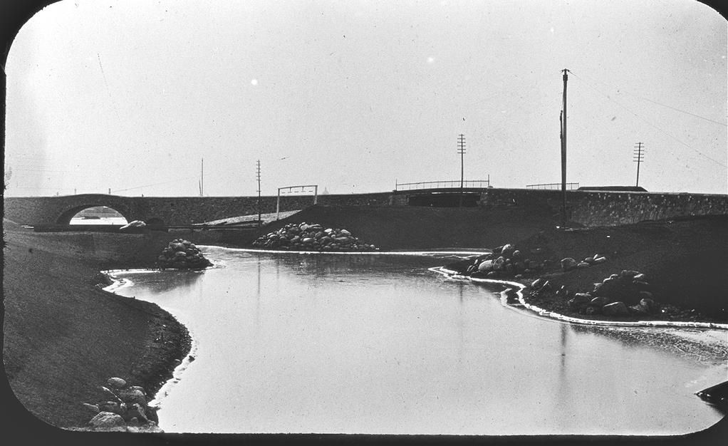
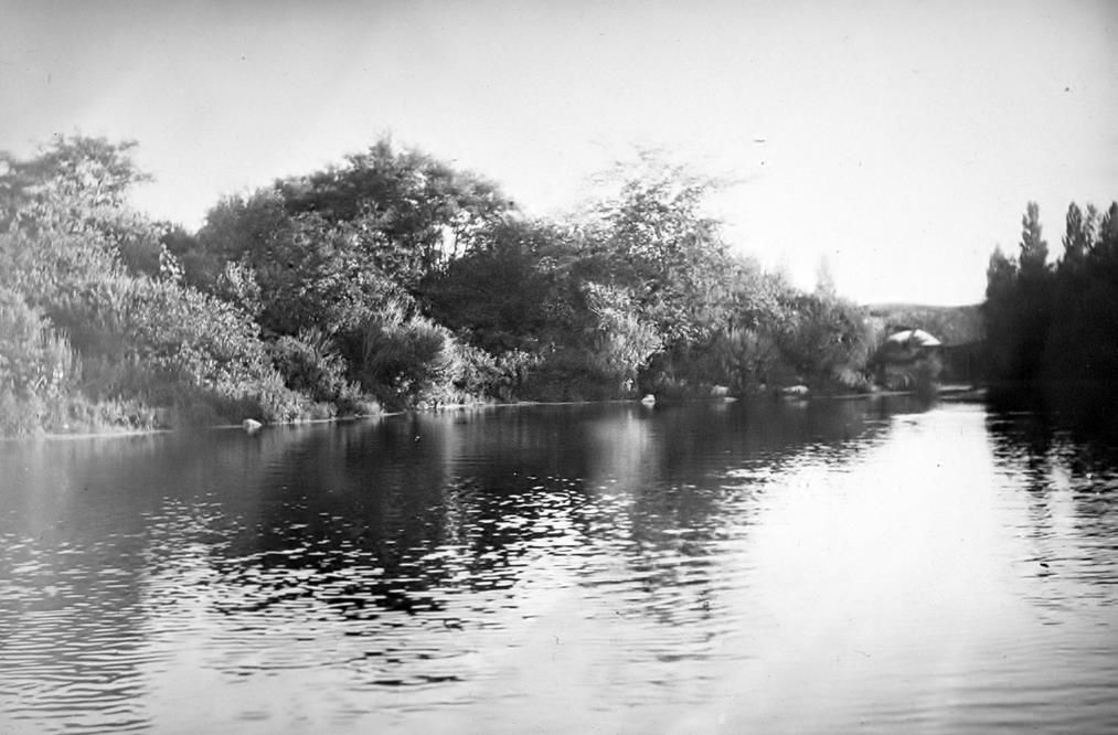
When the daylighting and other improvements are done (one section shown below), it's gonna be pretty nice!


No comments:
Post a Comment